予定では登頂第一候補日だった日は、前日の疲労を取るためと、天気がよろしくないこともあって、雪の上でロープで皆つないで行動する時の諸々の注意点の練習をして登頂は一日後にした。
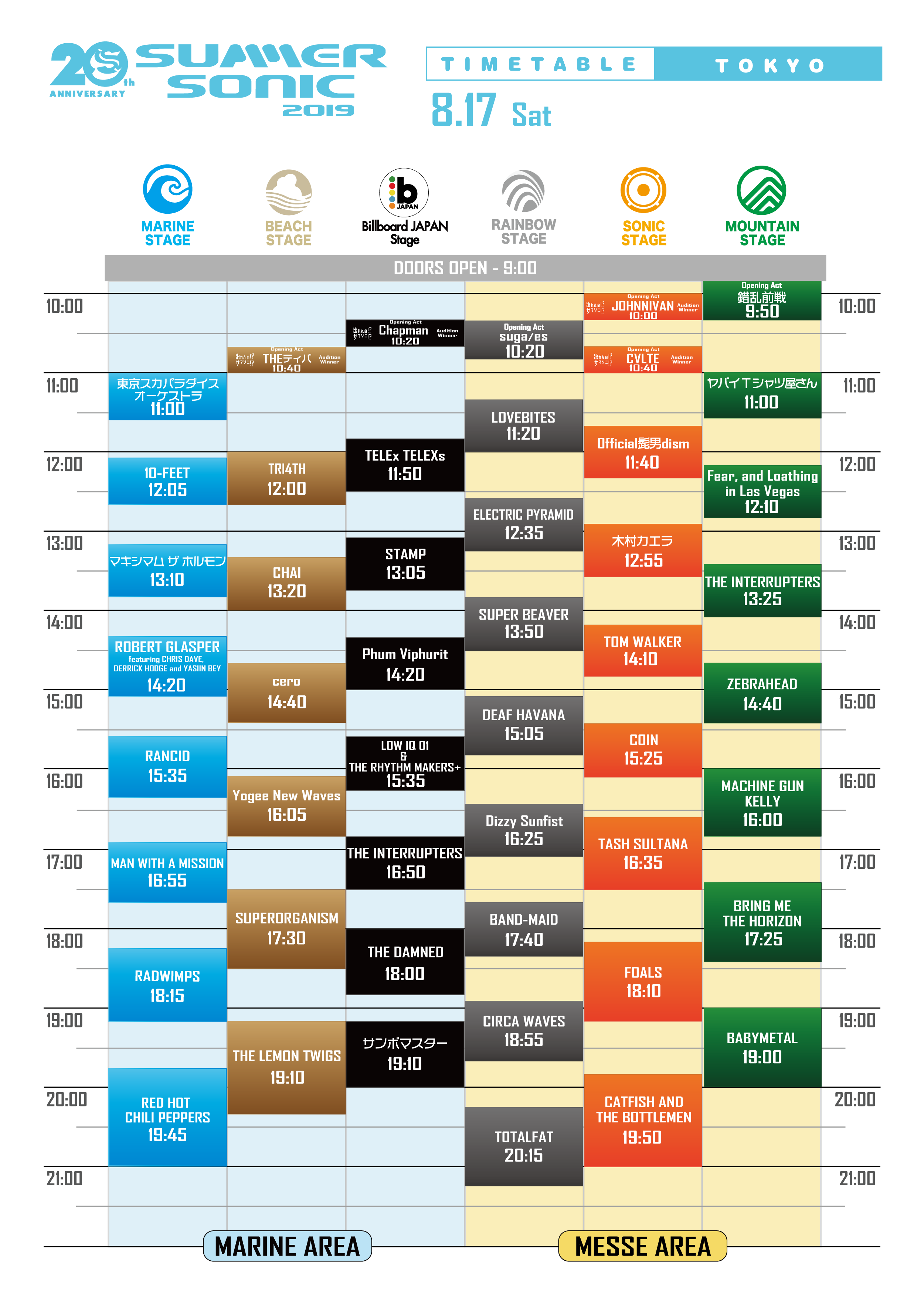
Summer Sonic 2019
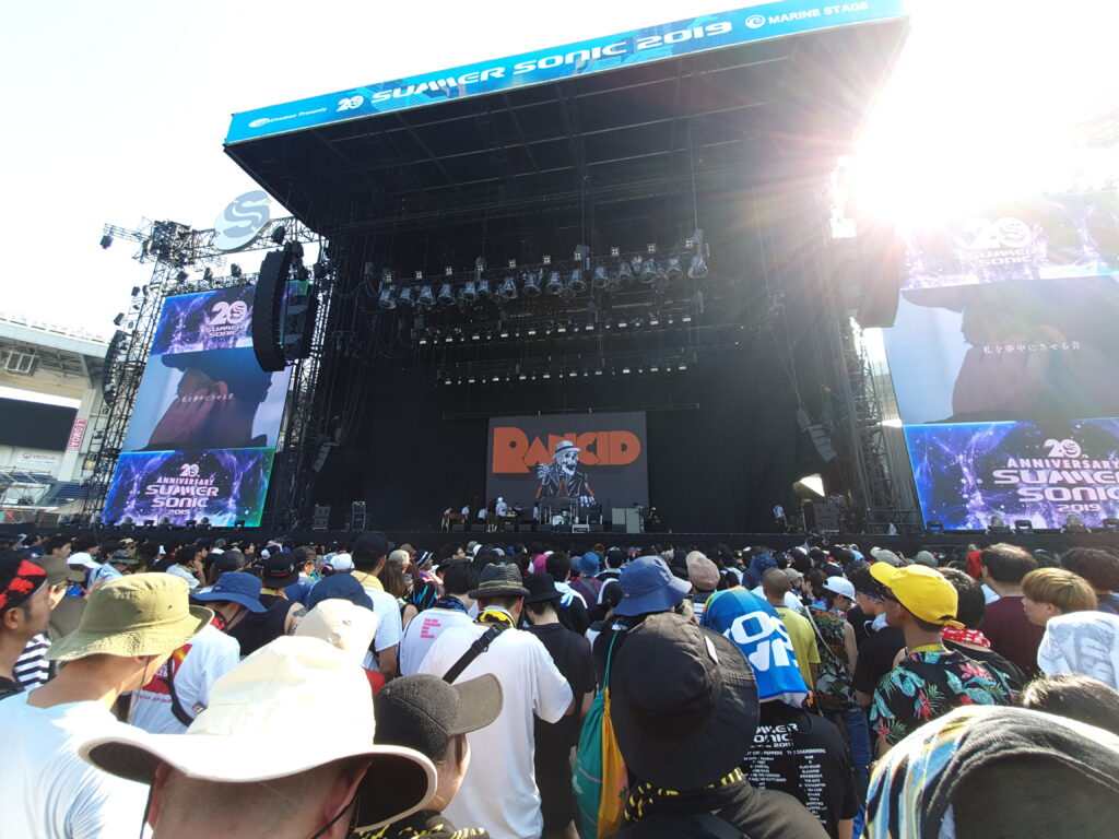
Once again Summer Sonic came up with a lineup that I couldn’t resist. Just look at that: Tokyo Ska Paradise Orchestra, Maximum the Hormone, Rancid, Man with a Mission, Babymetal and even Red Hot Chili Peppers? In one day? It was nothing short of intense.
Tanzawa
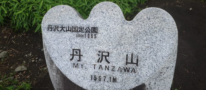
I’ve been thinking about climbing Tanzawa for a long time. It’s close to Tokyo and access is good. At the same time, depending on the route it can be exciting and long as well. The way I chose, starting from the Yabitsu pass, then going down towards Miyagase was both.
バレル
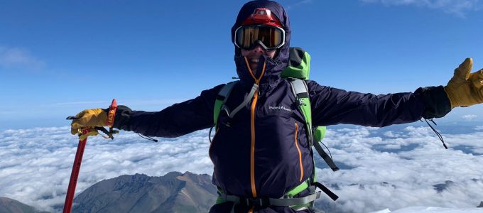
テルスコルのホテルで一夜過ごして久しぶりにシャワー浴びて、久しぶりにベッドで寝てからいよいよ本番の始まりだ。荷物整理して、ハイキング用の軽量装備などは置いて雪の世界に適したものだけ荷造った。また車で移動してそこからゴンドラやリフトで標高を稼いだ。目的地は標高3800mのバレル。昔はバレル状の”小屋”しかなかったが今はもうコンテナがメインになっている。
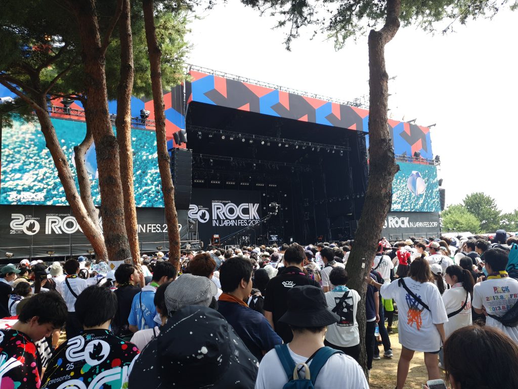
Rock in Japan 2019
今年もまたロックイン行ってきた。3日の土曜でメインの目当てはReol。とはいえラインアップが豪華で朝からほぼ最後まで楽しめた。
山を越えて谷を越えて
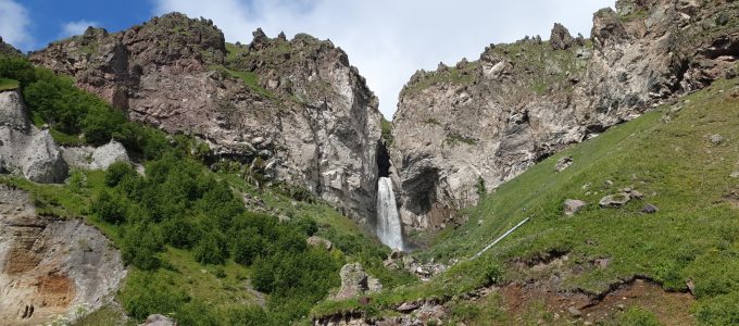
エルブルスの北の方、ふもとにあるハタンスのキャンプに2日すごしてから、その次の日は荷物をまとめて次のキャンプへ出発した。荷物のほとんどは車に積まれ運ばれたので、リュックは一日分の装備と絶対必須の3リットルの水のみ入ってた。初日に歩いた方面にさかのぼって、スルタンの滝の隣を降りて車道に出た。その周辺の鉱泉が健康にいいとか、かなり有名らしいので、人もそれなりにいた。
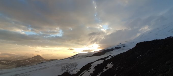
エルブルスが見えてくる
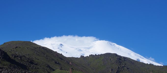
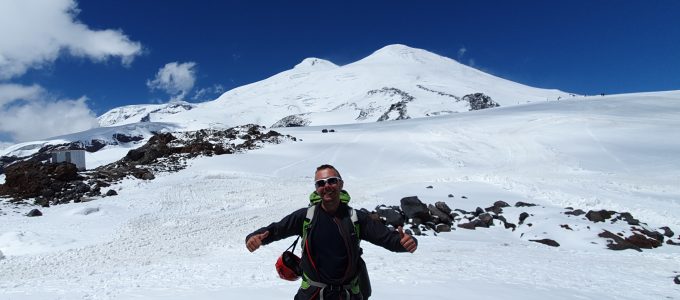
7月16日いよいよロシアのエルブルス山、ヨーロッパの最高峰に向かって出発した。荷物は95lのダッフルと55lのリュック。運よく飛行機の重量制限にピッタリとハマって追加請求が避けられた。とはいえ、石神井から成田までその合計30キロ以上を、朝の通勤ラッシュの中で運ぶのは決して楽しいことではなかった。
Elbrusz
Valamikor tavaly ősszel határoztam el, hogy nekiállok és megmászom a hét kontinens legmagasabb csúcsait. Ez Európa esetében a Kaukázusban lévő, 5642m magas Elbrusz. Lehetne róla vitatkozni, hogy ha csak ötven kilométerrel arrébb lenne a kaukázusi vízválasztó, akkor már Ázsiában lenne, de én nem fogok.
七大陸最高峰チャレンジって?
七大陸最高峰チャレンジは短くまとめると、地球の7つの大陸:アジア、ヨーロッパ、オーストラリ、北米、南米、アフリカと南極大陸を全部回ってそれぞれの一番高い山の頂上に立つというチャレンジ。
k3s
Having played around with the managed Kubernetes offerings of various cloud players (DO, AWS, GCP), I was wondering if it was possible to do this cheap. My site doesn’t have much traffic or anything complicated really, so running it off a $5 DO droplet is reasonable. Sadly managed Kubernetes offerings won’t come out so cheap. (Sure I could leech off the starting $300 GCP credit for a year then keep hopping accounts, but…)
Then I read about k3s. The people behind Rancher made it as a lightweight (but functionally complete) Kubernetes distro. Lightweight, they say… Just how light? (Imagine a weird maniac light in my eyes here.) Could I run it on a $5 droplet?